On a clear summer day in 1973, seven years before the eruption, I hiked through the forest with the Seattle Mountaineers to Coldwater Peak just north of Spirit Lake and Mount St. Helens. Today, the forest is gone and the view from the peak is very different.
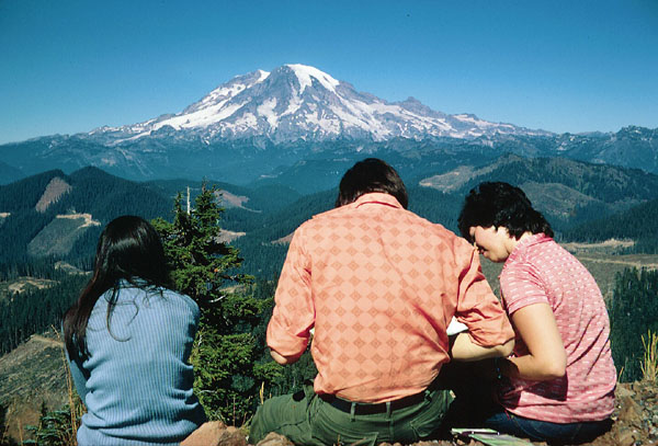
View of Mt. Rainier from
Coldwater Peak, summer 1973
The mountain began stirring in late March, 1980. By late April, the pristine snow cover was darkened from the frequent small eruptions of ash and steam.
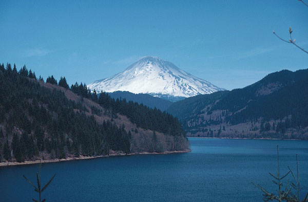
Mount St. Helens from Yale Lake,
late April 1980
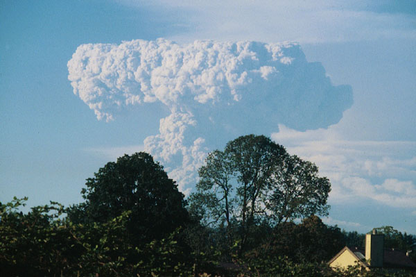
By chance, on the fateful day, I had planned a hike with friends up Mt. Defiance on the south side of the Columbia River about 50 miles south of Mt. St. Helens. By the time we arrived at the parking area, it was clear something big was happening. From high on the slope of Defiance, this is what we saw.
Eruption of Mount St. Helens
viewed from Mt. Defiance
These photos were taken with an Olympus OM-1 with 28mm to 400mm lenses.
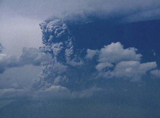
You are looking north. The ash cloud is blowing east turning day into night east of the mountain.
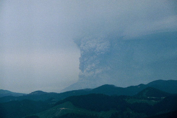
A wider view showing the Columbia River below us.
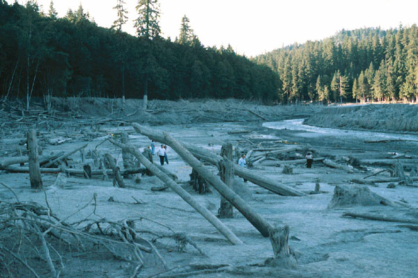
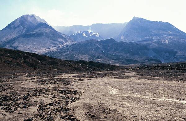
Months later, when what was left of the Spirit Lake Highway was re-opened, we could view the path of the mud and debris through the Toutle River valley.
From the north the view across the Plains of Abraham shows the new dome steaming inside the crater.
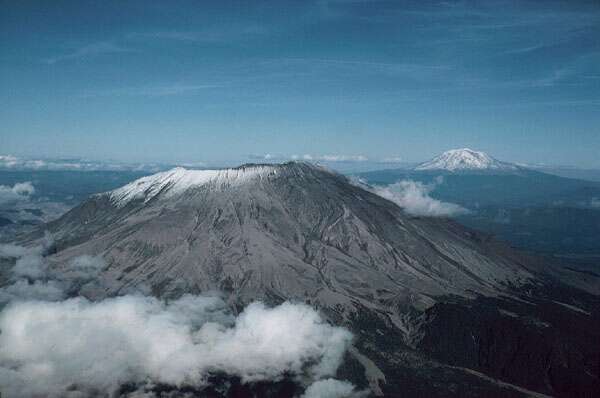
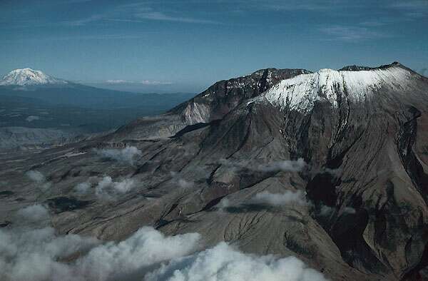
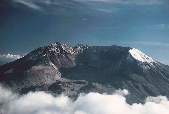
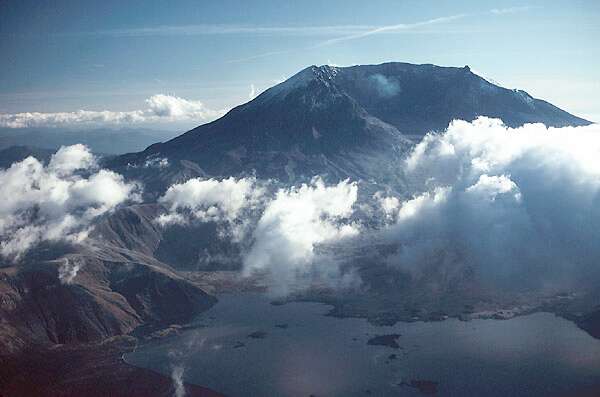
A flyover on a clear summer day provided these views of the aftermath.
This view to the east shows Mt. Adams in the background.
Farther around to the north, the crater comes into view.
Continuing to circle the mountain brings the crater into full view. You are looking directly south into the crater.
Below the mountain under scattered clouds is the new Spirit Lake partially covered with downed trees.
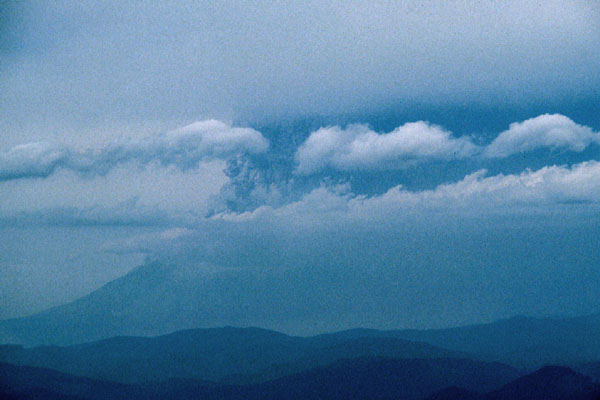
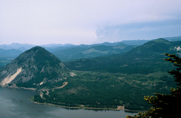
For months afterward, the mountain occasionally blew off steam and ash, sometimes showering the Portland metropolitan area with fine gray powder. This is one such eruption viewed from Cooper Mountain, a small hill near my home about 80 miles from the volcano.
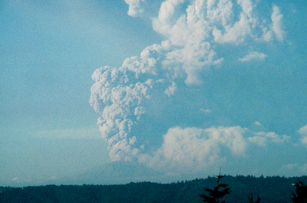
Another minor eruption.